Measuring Earth’s deformation
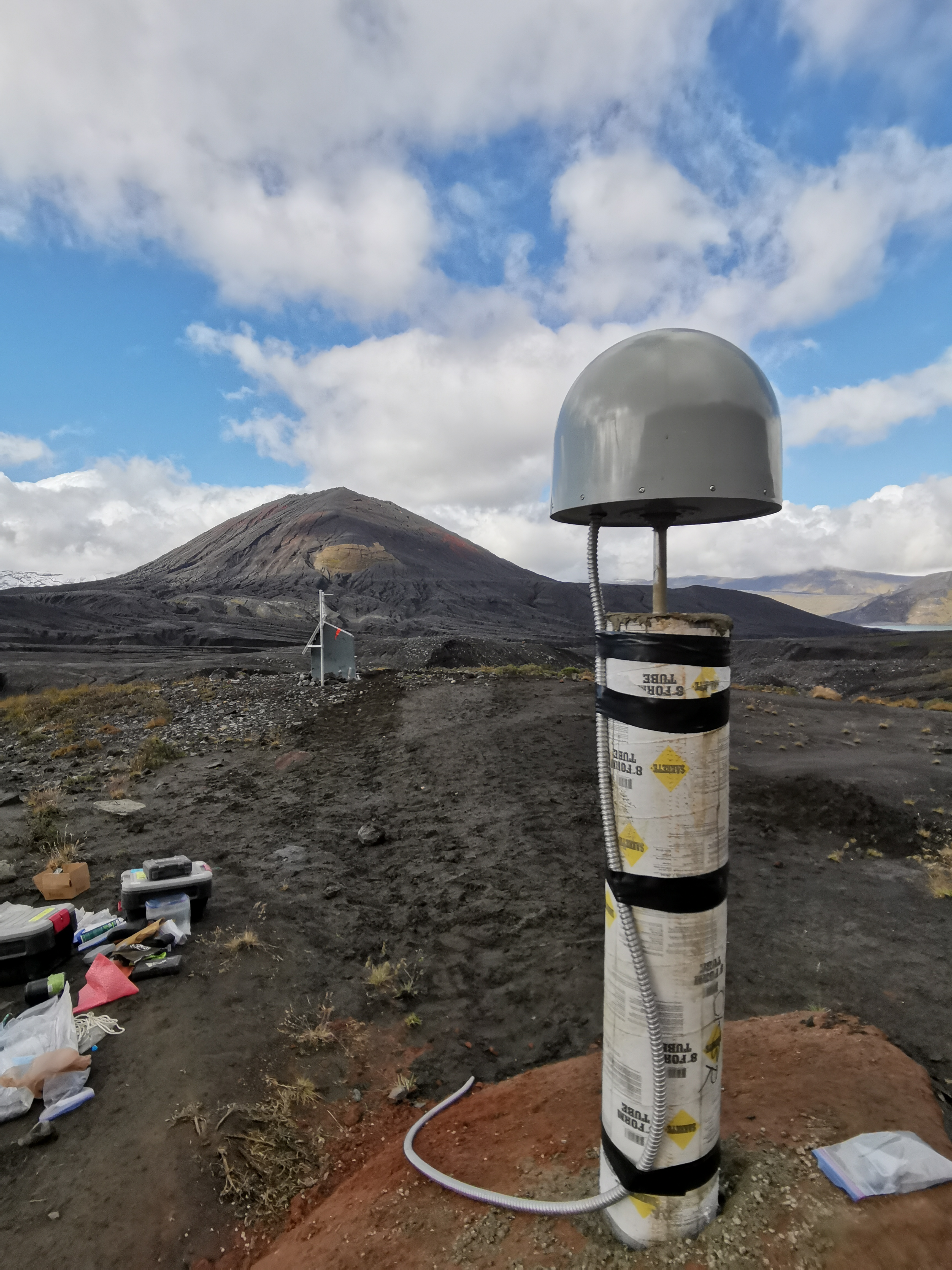
Geodesists use a variety of techniques to measure deformations in the Earth’s surface, such as satellite radar interferometry, Global Navigation Satellite Systems (GNSS), and ground-based strain meters. Satellite radar interferometry involves using radar images from satellites to measure very small changes in the distance between the satellite and the Earth’s surface, which can be caused by movements of the Earth’s crust. GNSS involves using a network of satellites to measure the precise location of points on the Earth’s surface, which can be used to track changes in the Earth’s shape over time. Ground-based strain meters are instruments that are placed on or near the Earth’s surface to measure very small deformations, such as those caused by earthquakes. Global Navigation Satellite Systems (GNSS), the most famous of which being the Global Position System (GPS), are one of the most commonly used means of measuring Earth deformation, due to the relatively low power and cheap electronics used to build ground receivers. GPS was initially developed as a military navigation system, but can now be accessed by anyone on devices such as a smart phone. A constellation of satellites broadcast ultra-precise clock times via carrier signals in the microwave frequency band (typically ~1.6 and ~1.2 GHz, known as the L1 and L2 bands, respectively). Ground receivers, which also contain a clock, compare the broadcast timestamps to the times at which they were received and (assuming the two clocks are synchronised) calculate a range from the receiver to the satellite. By calculating the range to a number of satellites, these ground receivers can estimate their position with a great deal of accuracy. Phase information can also be incorporated to produce the ultra-high precision measurements that are typically required for the study of surface deformation. Ephemerides for the GPS satellites—that is, tables of the exact orbital positions and other state-of-health information—are published regularly and must be accounted for when calculating the positions of the ground receivers. Other GNSS systems include the Galileo system (European Union), GLONASS (Russia), BeiDou (China), IRNSS (India), and the Quasi-Zenith Satellite System (Japan). A GNSS measurement site typically consists of a ground receiver and one or more antennas that are anchored to a stable platform. There exist a number of means by which such a stable platform is created, such as:- Steel rods epoxied into holes drilled directly into solid bedrock (ideally) or otherwise some large, stable rock
- Concrete pillars fixed to solid bedrock (ideally) or otherwise some large, stable rock
- Steel rods driven deep into some consolidated but non-bedrock ground
- Small survey monuments afixed in solid bedrock, which can be used to make campaign (non-continuous) measurements